Kind: Subsystem
Class: Support
Type: System
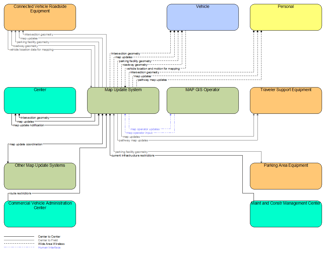
Map Update System
Overview
The 'Map Update System' represents a provider of map databases used to support ITS services. It supports the provision of the map data that are used directly by vehicles (e.g., roadway and intersection geometry data sets), travelers (e.g., navigable maps used for route guidance and display maps used at traveler information points), system operators (e.g., map data used by Traffic Operators to monitor and manage the road network, and map data used by Fleet Managers to manage a vehicle fleet). It may represent a third-party provider or an internal organization that produces map data for agency use. In the latter case, the 'Map Update System' is typically included as part of the center (e.g., a Traffic Management Center) of the infrastructure owner/operator that manages map data. Products may include simple display maps, map data sets that define detailed road network topology and geometry, or full geographic information system databases that are used to support planning and operations.
This physical object is included in the following Service Packages:
Functionality
| Functional Object |
|---|
| Map Management |
| Pathway Map Management |
Triples
Security
This physical object has the following security levels for the associated service packages.
| Physical Object Security | ||||
|---|---|---|---|---|
| Security Class | Confidentiality | Integrity | Availability | Service Package |
| Class 3 | Moderate | High | Moderate | SU04: Map Management |
| Class 3 | Moderate | High | Moderate | SU04.1: Wide Area Wireless Implementation |
| Class 3 | Moderate | High | Moderate | SU04.2: C-ITS Supported Implementation |
| Class 3 | Moderate | High | Moderate | SU04.3: MEC Supported Implementation |
Interfaces Diagram
Standards
The following table lists the standards associated with the physical object itself (as opposed to standards associated with an interface). For standards related to interfaces, see the specific information flow triple pages.
| Name | Title |
|---|---|
| OGC CityGML | City Geography Markup Language |
| OGC IndoorGML | Indoor Geography Markup Language |